RBGPF
-1.6900

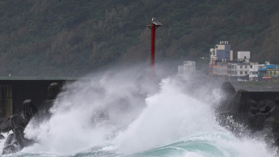
Super Typhoon Kong-rey made landfall in Taiwan on Thursday as one of the most powerful storms to hit the island in years, whipping up 10-metre waves and forcing thousands of people to flee their homes.
Packing maximum wind speeds of 184 kilometres per hour (114 miles per hour), Kong-rey hit the east coast at Chenggong town in Taitung County at 1:40 pm (0540 GMT), the Central Weather Administration said.
It was the same strength as Typhoon Gaemi, which was the most powerful storm to hit Taiwan in eight years when it made landfall in July, but Kong-rey's radius of 320 kilometres made it the biggest in nearly three decades.
"Its impact on all of Taiwan will be quite severe," Chu Mei-lin from the state weather forecaster, Central Weather Administration, warned.
Work and schools across Taiwan were suspended on Thursday as people hunkered down ahead of the storm.
The streets of Taipei were largely deserted as bursts of heavy rain and fierce wind lashed the capital.
"This typhoon feels very strong," 52-year-old office worker Kevin Lin told AFP as he enjoyed a day off at home.
"I'm used to the many typhoons in Taiwan and I don't feel scared."
- Troops on standby -
At least 27 people have been injured in the wild weather, with trees knocked down and four mudslides recorded, the National Fire Agency said Thursday, without providing details.
Authorities were still trying to contact two Czech tourists who were believed to be hiking in Taroko Gorge in Hualien after they could not be reached on their satellite and mobile phones.
More than 400 domestic and international flights were cancelled while all ferry services were suspended. Around 18,000 homes lost power, but most have been reconnected, disaster officials said.
Taiwanese tech giant TSMC said it had "activated routine typhoon alert preparation procedures" at its chip-making facilities and did not expect a "significant impact" on operations.
Kong-rey was travelling at a "relatively fast" 21 kilometres per hour as it swept across the sea towards Hualien and Taitung counties, Chu from the state weather forecaster said.
The storm was expected to weaken after hitting land and then move across the mountains that run down the centre of the island before exiting over the Taiwan Strait in the evening, Chu said.
But she warned that the storm would "severely" affect the island all day and into the early hours of Friday.
More than a metre of rain could fall in the hardest-hit areas along the east coast by Friday as the seasonal monsoon also drenched the island of 23 million people earlier in the week, prompting warnings of landslides.
Authorities have evacuated 8,600 people from their homes in vulnerable counties and cities, including Yilan, Hualien and Taitung, according to the National Fire Agency.
Forecasters have warned of "destructive" winds from Kong-rey, and nearly 35,000 troops were on standby to help with relief efforts.
President Lai Ching-te urged people to avoid "dangerous behaviour" like going to the beach to watch the waves.
Scientists have warned climate change is increasing the intensity of storms, leading to heavier rains and flash floods and stronger gusts.
Kong-rey was the third typhoon to hit Taiwan since July.
Gaemi killed at least 10 people, injured hundreds and triggered widespread flooding in the southern seaport of Kaohsiung.
That was followed in early October by Krathon, which killed at least four people and injured hundreds, triggering mudslides, flooding and record-strong gusts.
D.Al-Nuaimi--DT